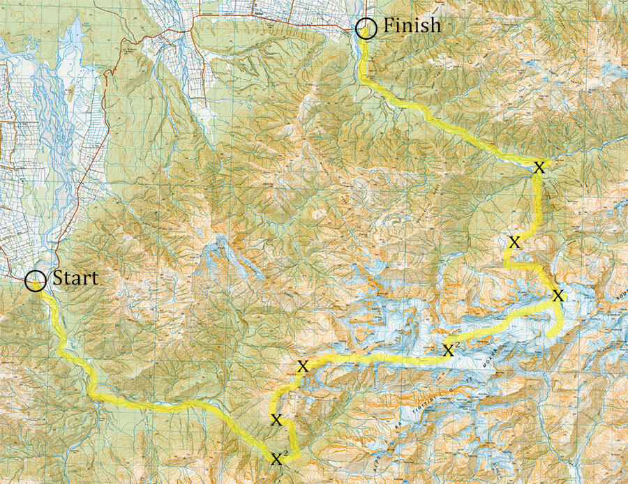
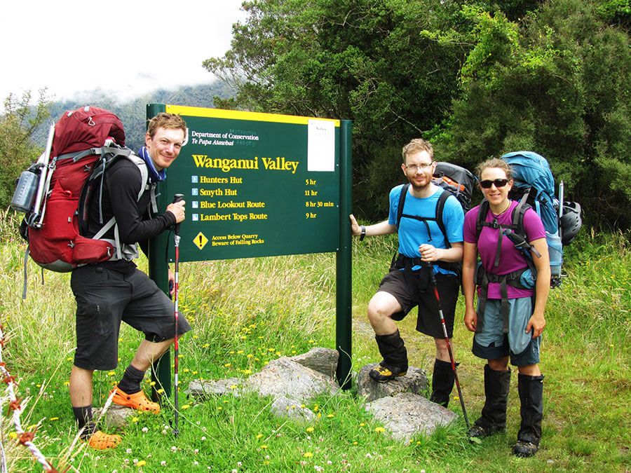
The Route
- Across the Garden of Eden and Garden of Allah ice plateaus
- Total Route: ~95km
- Total Time Taken: 10 Days
- Number of Bad Weather Days: 2
- Average Pack weight at Start: 25.5kg
- Longest Day: 14hours
- Height Climbed: ~8000m
Day 1 – Whataroa Highway to Scone Hut.
After waking early in the Harihari Hotel from a night on a bunk mattress, we were filled with excitement of the days ahead and the goal to reach the Garden of Eden and Garden of Allah ice plateaus. The cold air rushed through the corridors as we ate our breakfast and brushed out teeth, hoping for a lasting taste of minty freshness.
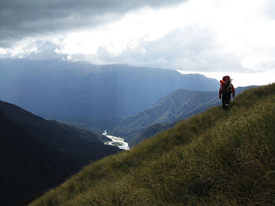
We caught a ride with a family relative of sorts and got dropped off at 8.30am at the Whataroa Tourist Recreation Center, the local helipad where they fly the scenic glacier tours from. So there we were, ready to start, surrounded by steep sided mountains and running water. As usual, I’d forgotten something. This time it was to put my gaiters on, so quickly removed everything from my 25kg pack and embraced the lower leg covering having totally forgotten about the hook grass and how sticks to your legs like superglue.
We all looked at each other as we began to take our first steps on this adventure, not knowing what lay ahead. We sauntered off along what seemed to be a good track towards Nolans Hut, but immediately lost the path, distracted by some bee hives in the distance. We retraced our steps and took a line much closer to the river. Perfect. Rejoining the track soon after following DOC markers, the snow capped peaks in the distance called us closer.
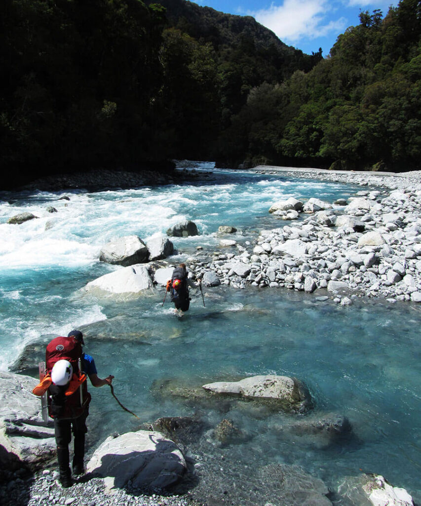
After crossing the Whataroa River, we climbed above the steep gorge towards Nolans Hut, taking in the incredible beautiful West Coast bush. We reached the hut within in 6 hours, just in time for a lunch break on the banks of the Perth. Floating along the river next to us were some heli-kayakers who had stayed upstream overnight and thrashing down the grade 3 & 4 rapids towards the ocean.
After we regained some strength and re-hydrated, threw our packs back on and marched onwards. Up ahead the track was totally washed out and it took us ages to climb and clamber up the scarp slopes and steep cliffs to get back to high ground and the original path route. Our bodies were already smashed and we’d pretty much had enough by the time we got to Five Finger Stream. Darkness was suddenly on our minds. This was day one and it had taken over ten hours… What the hell had we signed up for?
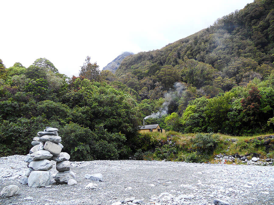
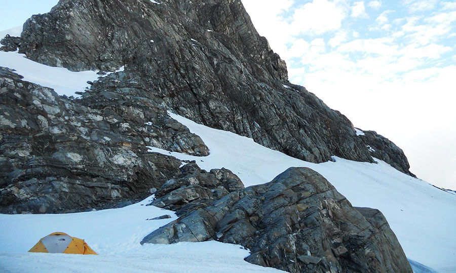
We pushed for another hour and a half and to our surprise, nestled in the back of a clearing, there it was. Scone Hut in all of it’s glory, and before dark too! We collapsed, our hips & feet throbbing after a very long day! We sat for a moment and contemplated our trip. The weather looked as though it was turning, so we got the stove on and read visitors book. We were very relieved to read that Guy Mackinnon made it from the road end to the hut in eight hours and 45 minutes, so we really didn’t do too badly on day one with our heavy packs, laden with 12 days of on our backs.
Day 2 – Bad Weather Day.
If the weather gods exist, they must have heard our groans and pains on day one. They nicely sent some heavy rain for us as we awoke to the sounds of light drizzle on the rooftop, getting steadily worse and worse. After a brief discussion, we decided that it was not a good day to climb up a waterfall, so took it as a rest day and made ourselves comfortable in the hut for the day, chopping wood and reading a lot of old FMC magazines.
I have never before seen a river rise so quickly, nor tun from a beautiful clear blue to an angry grey, such an incredible sight. We didn’t manage to accomplish much else on the day, but we’re now dab hands at double ended sawing.
Day 3 – Scone Hut to Elizabeth Stream.
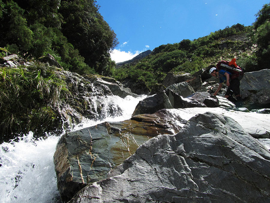
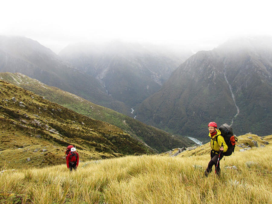
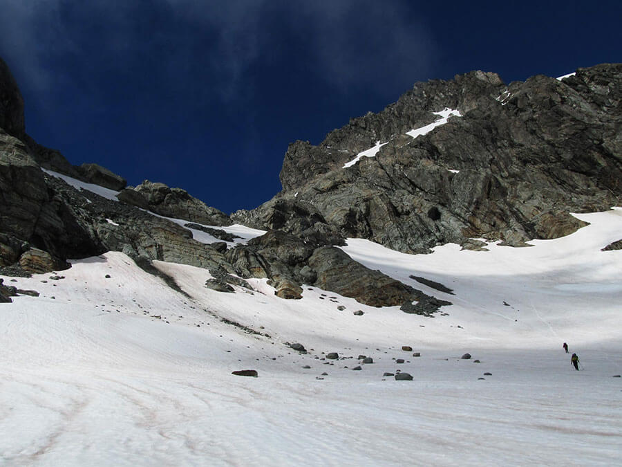
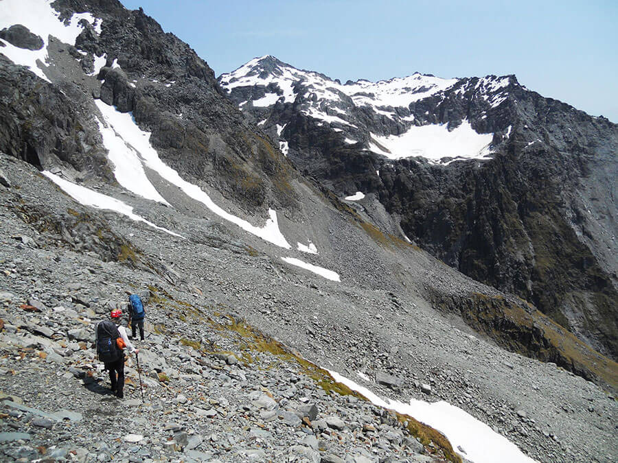
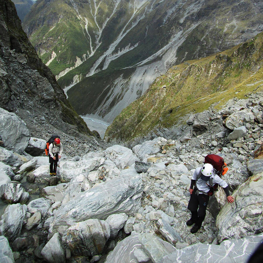
The day of reckoning came and the blue sky appeared above. We left Scone Hut around 8.30am and headed towards Redfield Stream for the first part of our trip. We had to beware about 1km up the stream as the route heads into the forest to the side of the river and only a tiny cairn leads the way up a river channel. Bashing through the trees, we reached the major river junction within the hour and started the battle up Redfield Stream.
The river itself was beautiful and easy to access, however as gorges and waterfalls appeared above us, we decided to take a route to the east directly up the slope, as to take in a route under the large waterfall. Taking handfuls of scrub and grabbing to vegetation we advanced up through vertical bush for two and a half hours before hitting the top waterfall. Dave had issues near the top where he had a fight with a flax bush that speared him through his shirt, but was alive to tell the tale.
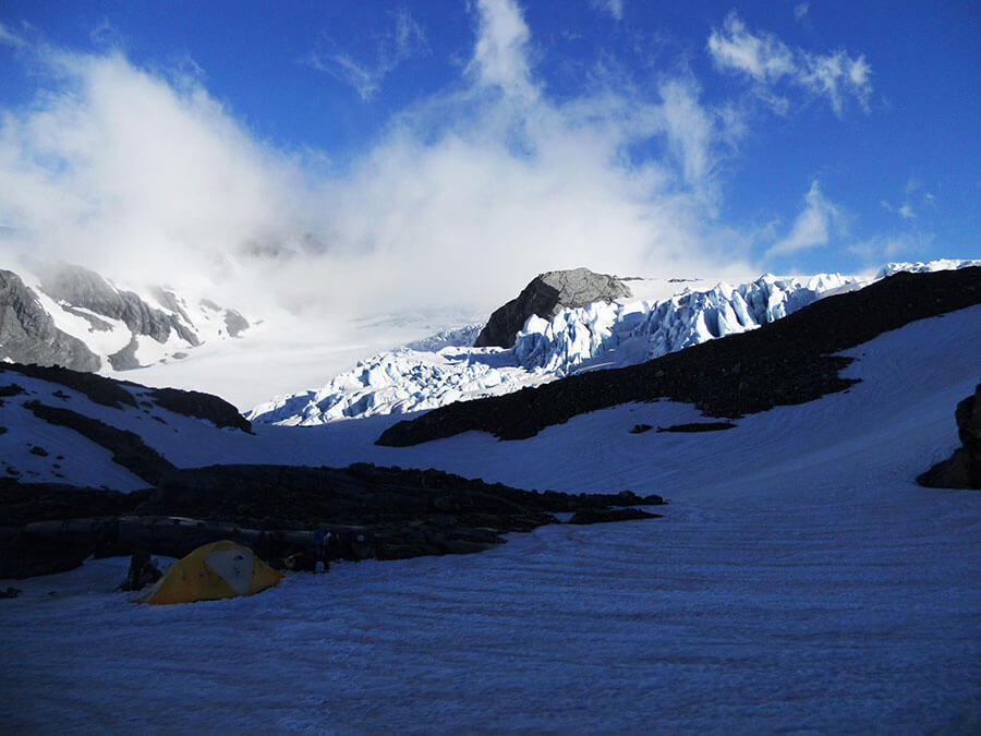
Scrambling up a steep ravine, we saw the bushline and ‘flatter’ ground. A momentary pause and small climb later we hit 1250m and traversed around bumpy and uneven tussock and underlying rocks until dusk where we hit an incredible camp stop at Elizabeth Stream Flats, close to 8pm.
Day 4 – Elizabeth Stream to Unknown Flats via The Great Unknown Summit.
We were up semi-early after a long third day to check the status of the weather. It looked clear, so we packed up and started on our climb towards the Great Unknown.
As we climbed to the ridge next to our previous night’s campsite, it clouded in for the rest of the day. Also, there was no extra water to be found but we checked for camp spots along the way just in case the weather closed in even more and we had to bail out!
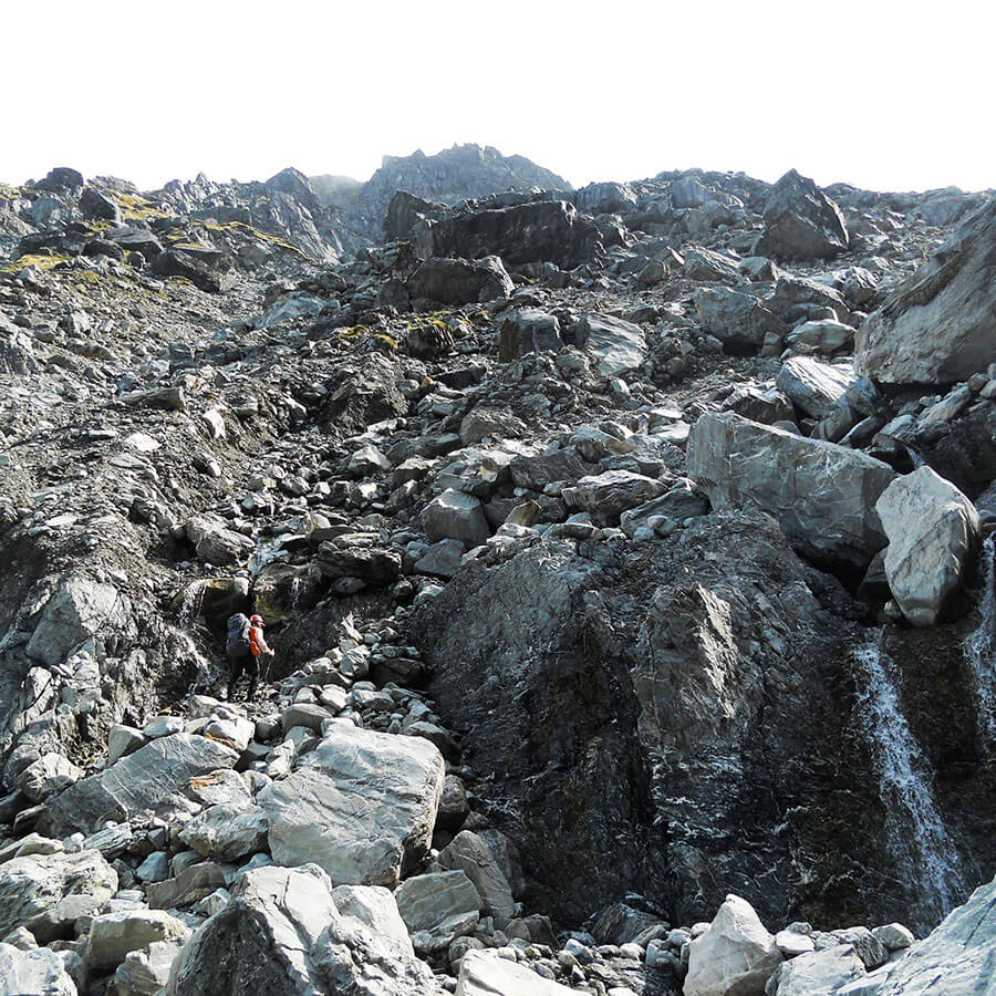
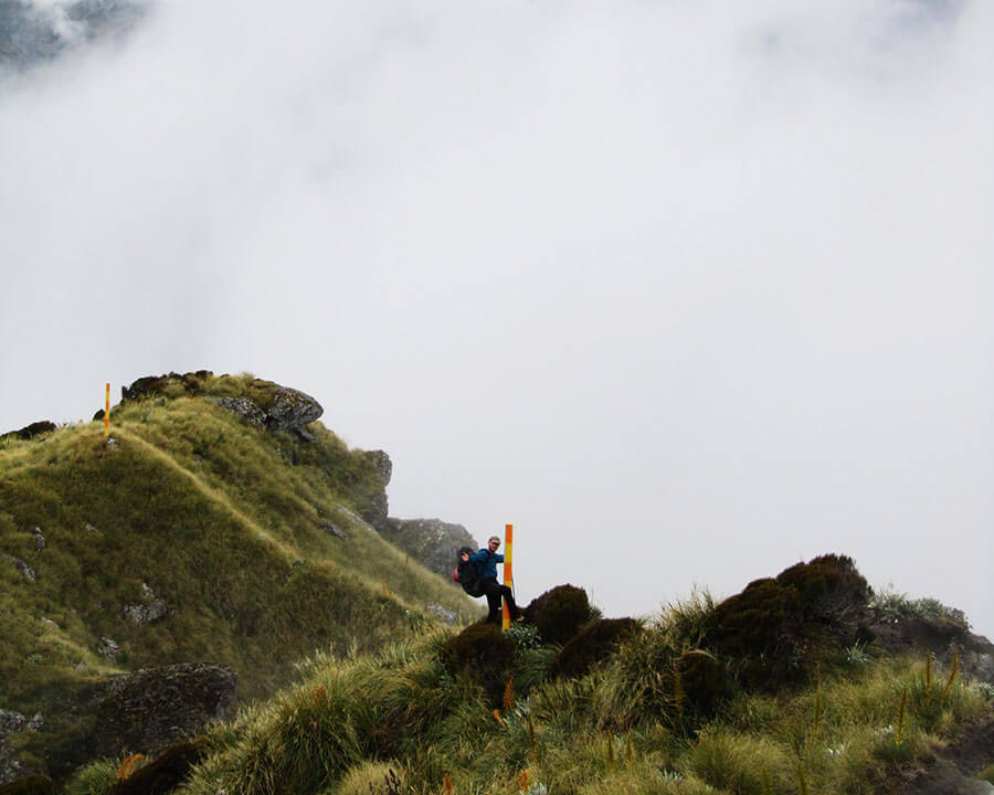
Whiteout after whiteout, we kept ascending the Great Unknown towards point 1898m, sidling around rocky stacks & the back of sharp ridge.
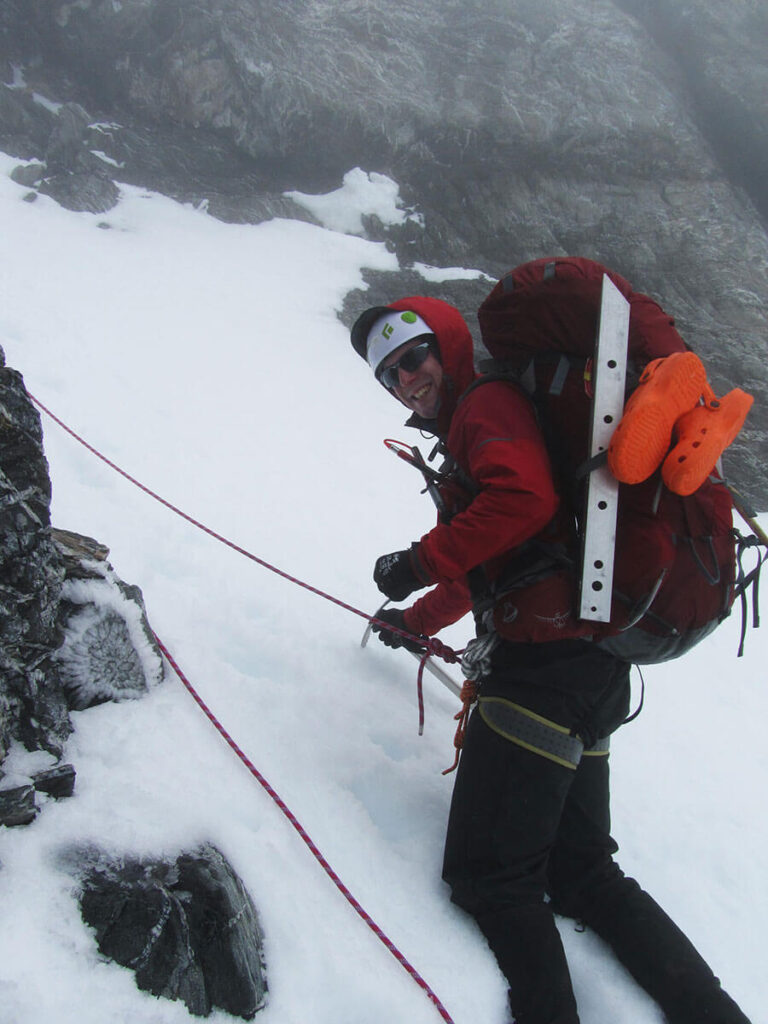
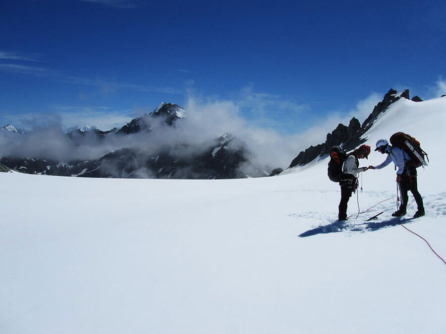
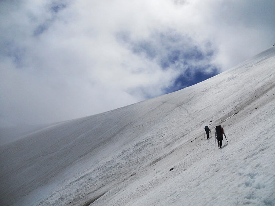
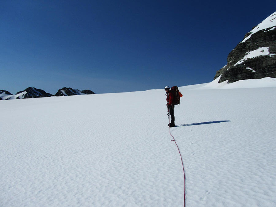
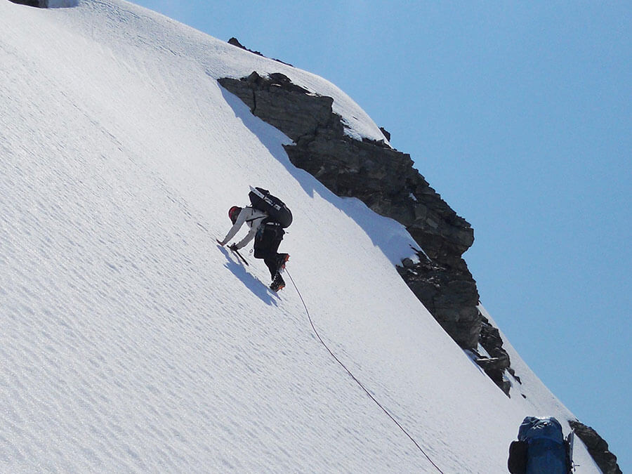
As it wasn’t clear what state the ice was in, we decided to put crampons on at 1900m, stepping onto the Adverse Glacier for the final ascent to the Great Unknown. We roped up on traverse and as if by sheer luck, I immediately fell in a crevasse after taking less than five steps. After scrambling out of my first ice hole of the week, we pushed on to the top and reached what we assumed to be the summit at 4pm (we could see nothing)!
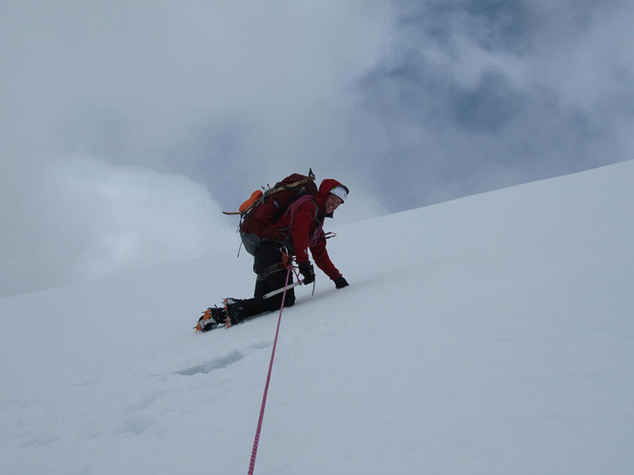
Our descent was intersected by our first navigational argument. We started our descent to the North West, and then down the wrong gully which would have taken us back towards the Barlow River. Thankfully after a lot of compass bearings, and climbing back to the summit to check, we took a better route down, but needed abseil assistance to get down.
Fully roped up again, we started down-climbing the 400m vertical to our campsite on the flats beneath. Visibility was still pretty poor as we descended but the next morning, we were stunned about our location.
Day 5 – Unknown Flats to Adams Col.
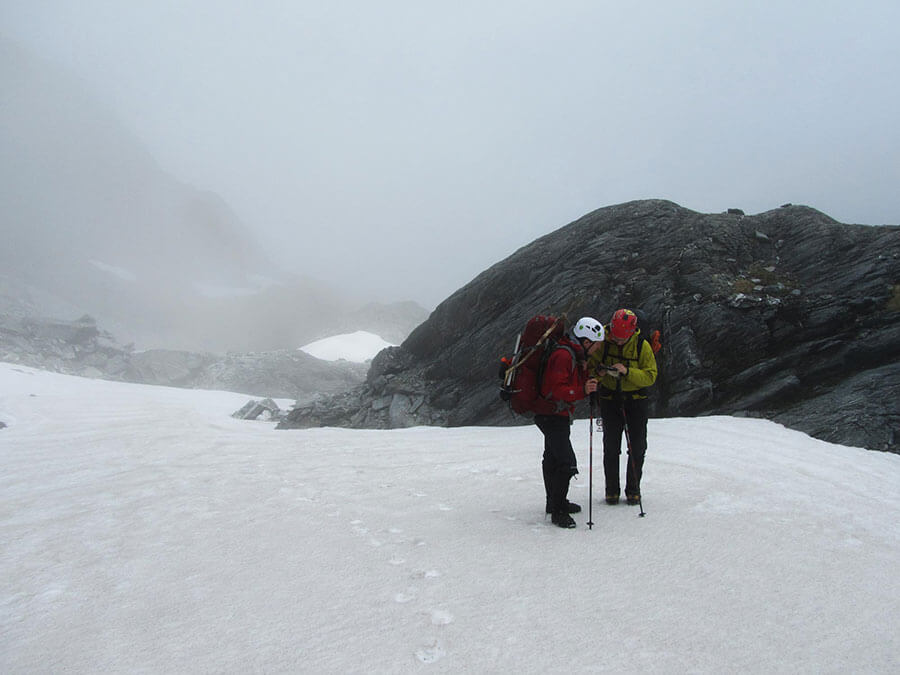
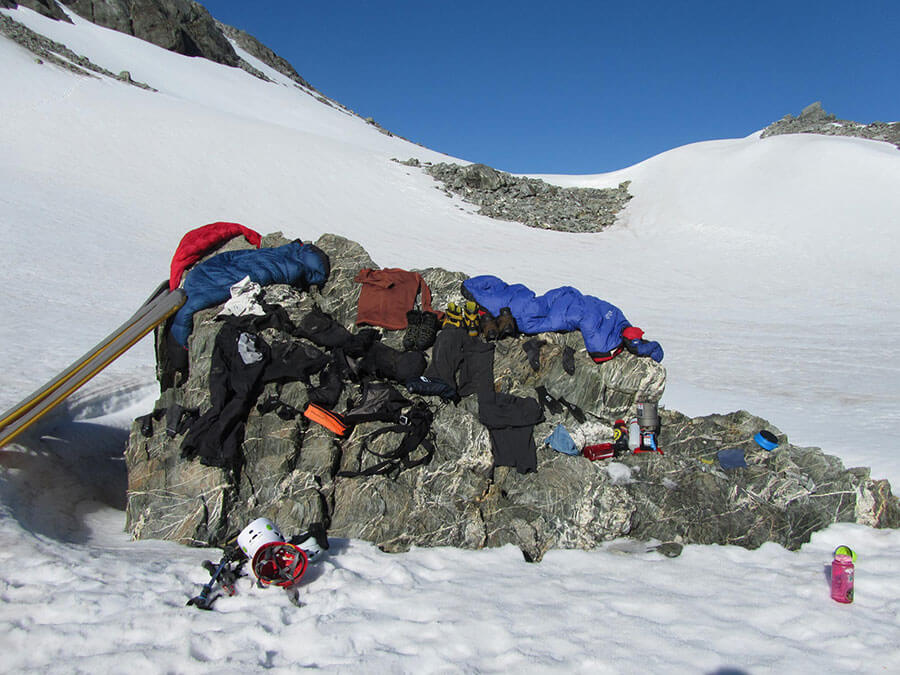
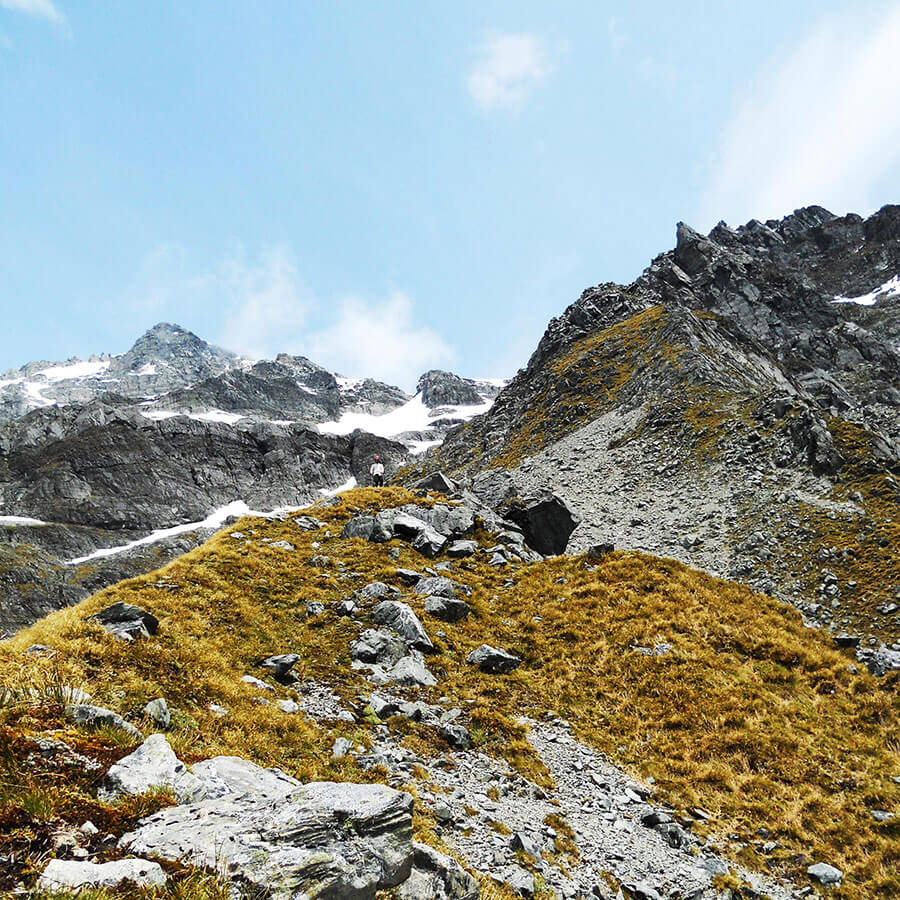
We awoke again to blue skies and immediately put all of our snow soaked gear on a rock to dry whilst we took trips to the northern slope to gaze out across the Barlow towards Mt Adams. What a view. After warm drinks and food, we packed up to leave at around 10:30am and scrambled across the rugged terrain that lead to the Gardens‘ entrance.
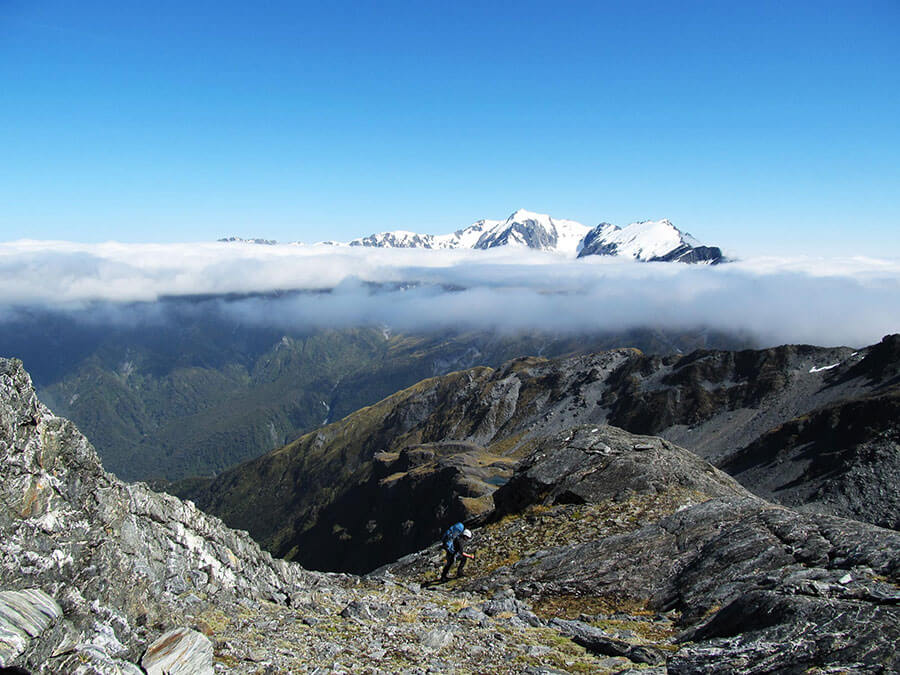
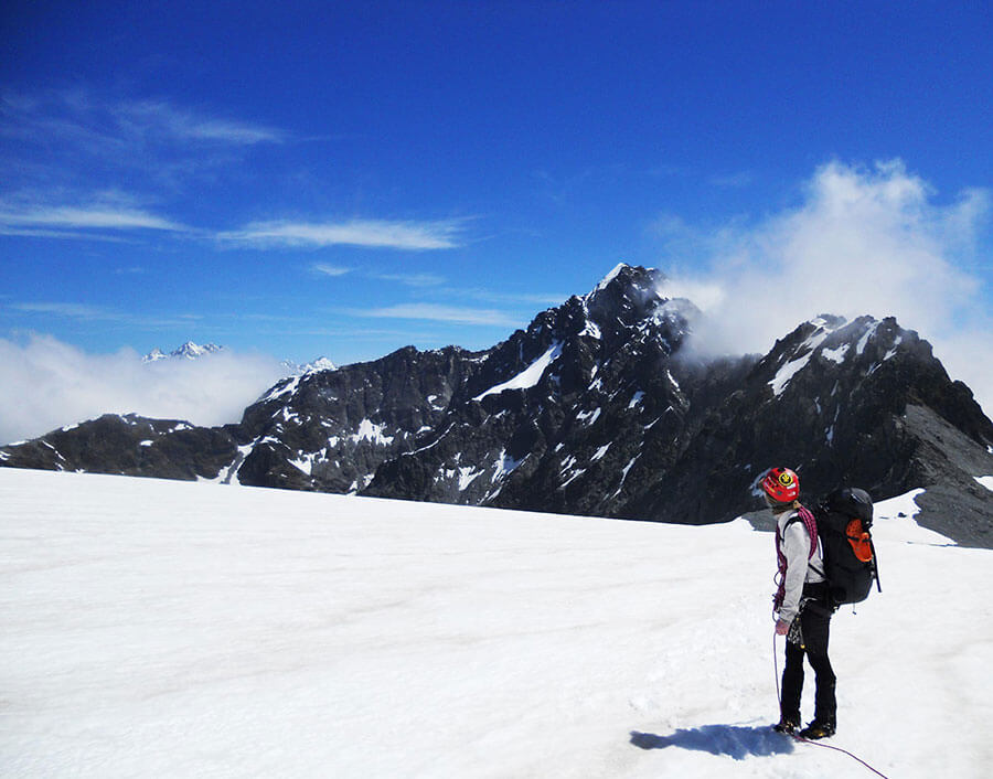
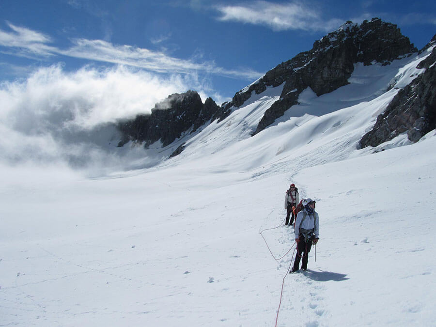
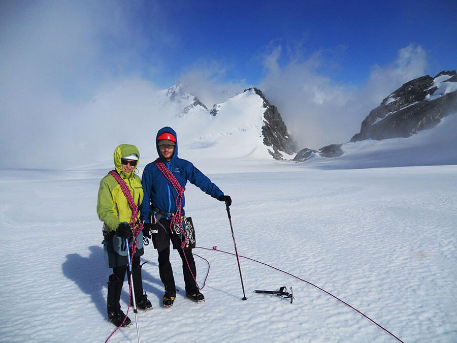
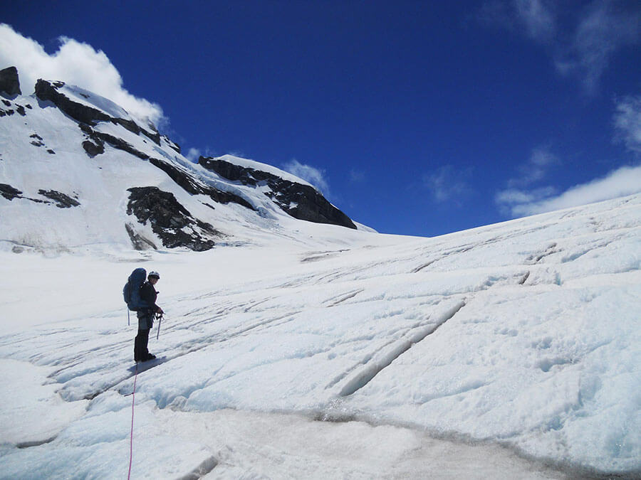
It took us until 3pm before getting to the Garden of Eden after avoiding numerous bluffs and rocky traverses, but it was so worth it. At our lunch stop we watched numerous rockfalls crash past us towards Perverse Creek from the slopes above only to finally reach the Garden of Eden in all of it’s glory. It was an incredible sight, the layers of ice upon ice that we’d been waiting for. A quick drink and we were ready for roping up.
Looking behind us (and this time trying not to fall into crevasses in front), the Great Unknown looked epic and majestic. It’s such a pity that the view of the peak wasn’t visible yesterday as it would have been stunning. Nikki took the lead on the rope for about 5 hours, plugging each new step through at least 30-50cm of fresh snow. We marched on, in-between Vertebrate Col and Little Unknown (2068m) towards the campsite goal of Adams Col.
We skirted across the upper levels of the Abel Icefall towards Angel Col through several whiteouts but our lines and compass bearings were enough to get us to the correct spot on the Col, with just a descent and ascent to go before hitting Adams Col.
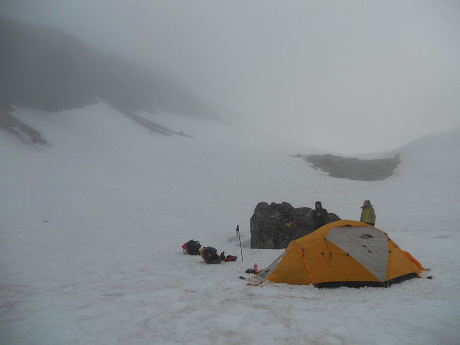
At this point, Dave took over at the front of the chain and we reached Adams Col before dark (9pm), and more importantly before the rough storm that was fast approaching.
It was a long day considering we only traveled 9km, but we were tucked up in bed and toasty warm quite quickly after some great food and having had numb feet for most of the afternoon.
Day 6 – Bad Weather Day #2.
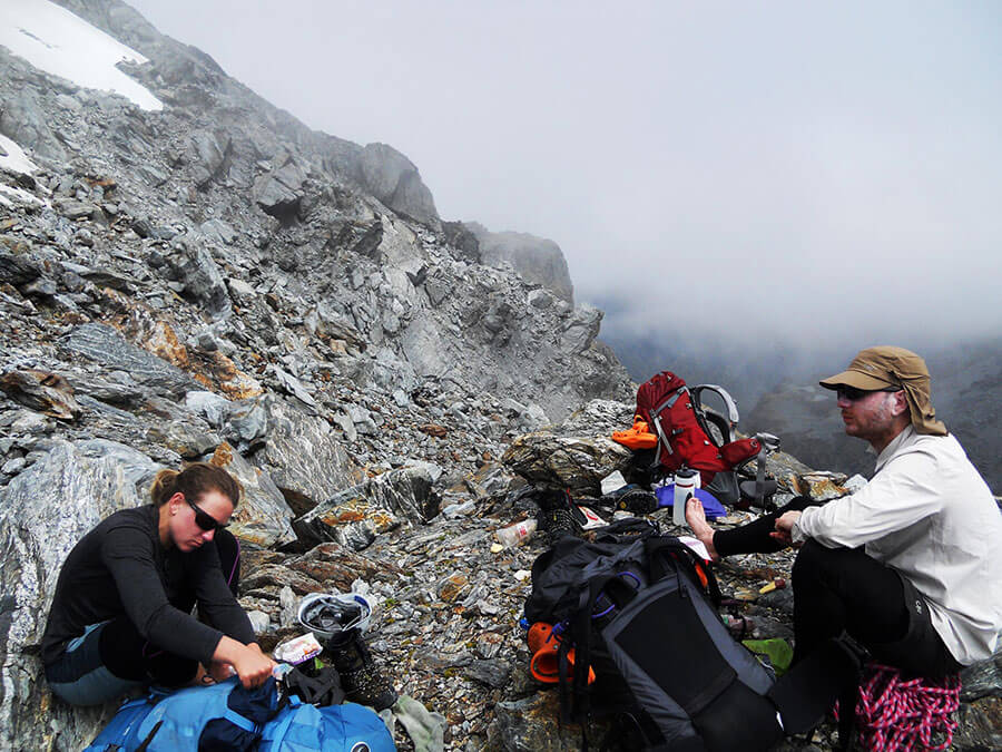
Again we were struck by bad weather. The storm battered our tent from midnight and continued to rain/snow into the next day until around 6.30pm. Adams Col was thankfully sheltered but we still had to dig deep and use our walking poles and axes to anchor the tent in place as the winds were so strong. Unfortunately, one of the poles didn’t make it!
We spent the day not drinking much (as we didn’t want to step outside the tent) and we became champions of crosswords and rummy, so it wasn’t all bad. The only problem we had was that the inner was getting wet somehow and was dripping exactly where my head was lying… one of those annoying things that fascinates you when there’s not much else to do…
We kept peeking out to see if the rain had stopped and low and behold, about half way through the storm, we spotted another tent in the opposite side of the Col resting on the rocks. Small world, and the only 2 people we saw all trip!
The weather totally cleared at 8pm and we were surrounded by blue skies at last. It was as if we were in another world. The blue and the fresh snow made it time for us to cook outside for our evening meal before tucking back inside to sleep.
Day 7 – Adams Col to Lambert Icefall.
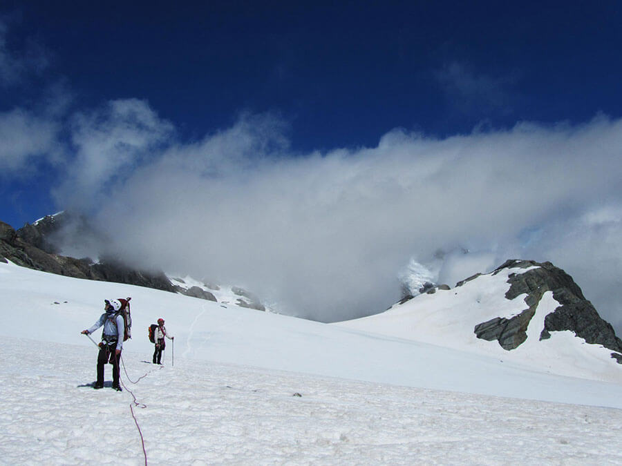
Day 7 was to be our shortest day on our feet yet. We awoke to amazing skies yet again and quickly packed up and had a mini adventure on the plateau above before descending through Adams Col towards the Garden of Allah.
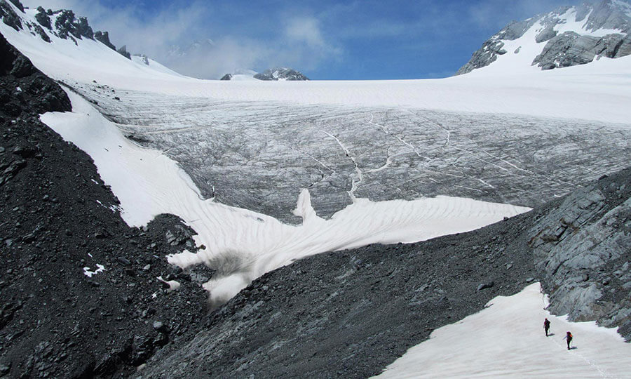
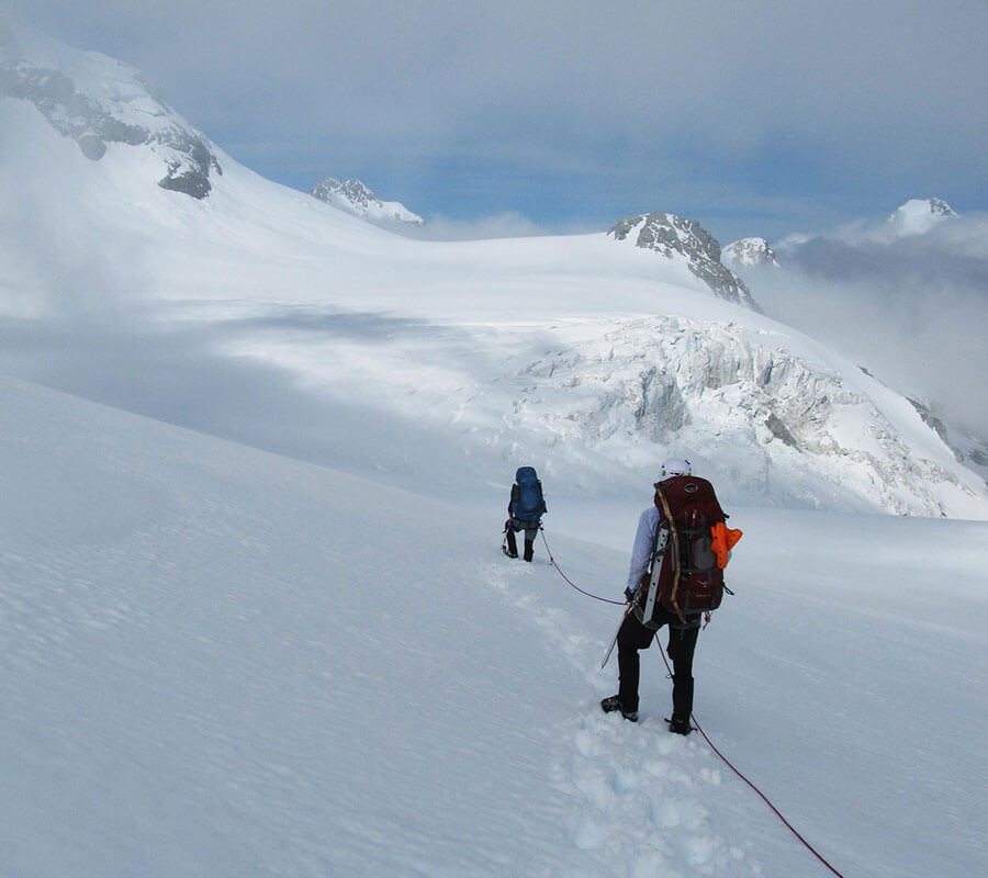
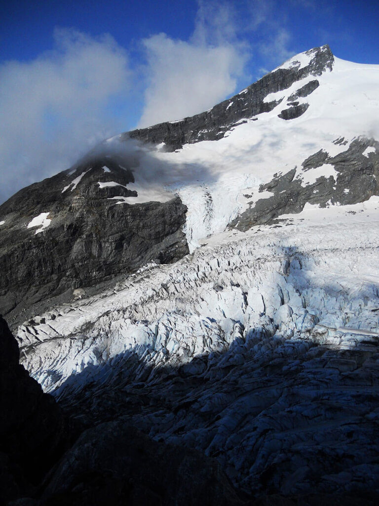
We descended down the rocky route to the south through the west side of Adams Col and zigzagged our way down to Icefall Outlook where the Beelzebub Glacier was cracking and breaking off as the sun rose in the sky. It was probably one of the most picturesque views of the trip, hundreds of ice seracs pointing in every direction, like a solid flowing river raging down the valley.
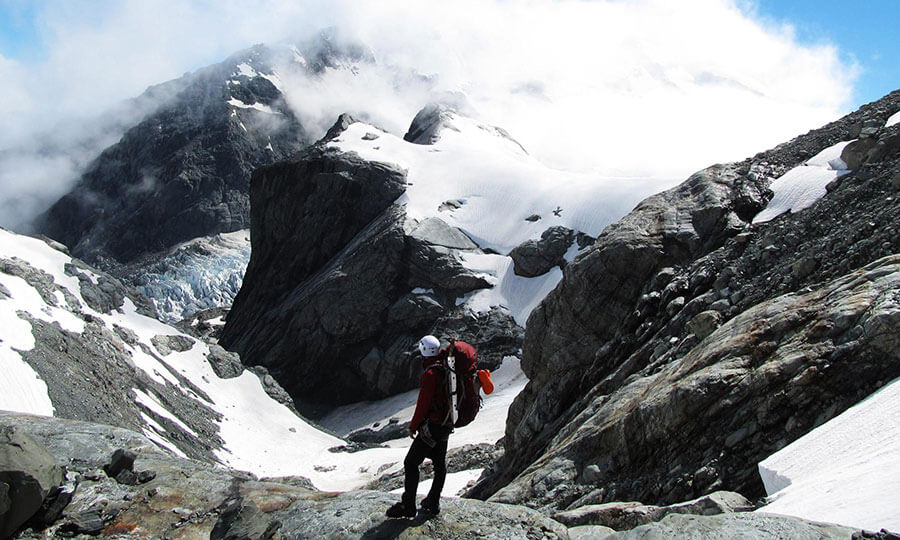
We ascended the slope up to the glacier above and saw the Tears of Allah Buttress to our right, a piece of rock that Guy McKinnon and the late Jamie Vinton-Boot first ascended in April 2008. It was stunning rock all around as we hit hard ice for the first time in two days.
Unfortunately as we stopped for lunch and used our sat phone to check the weather before hitting Satan’s Saddle, a whiteout hit us (as it seemed to do mid-afternoon on the plateau) and we were blind in all directions. The only tools we had were compass, map and altimeter as we edged slowly up to the saddle, carefully watching for crevasses. Nikki took the lead on the downward descent along the northern tongue of the Garden of Allah, along the vertical slopes of Mt Lambert. This part of the traverse was the most scary to be honest as we were blind, and all we could head was cracking ice above as hanging glaciers thawed and came crashing down towards us on the soft plateau below.
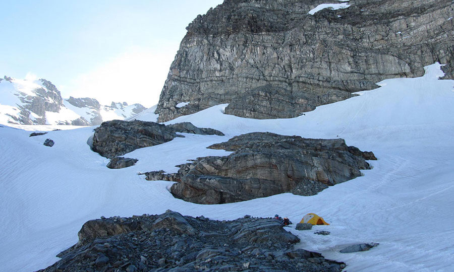
However, we successfully navigated (although slowly and with a lot of shouting ‘left’, ‘right’ and ‘straight on’ from the back) down the ice for a good 3-4 hours until we hit a set of huge crevasses right at the foot of the buttress of point 1967m. We thought we should be about 300m away from our camp for the day (but couldn’t see much as the whiteout had got a lot worse) but in front of us lay a crack about 2m wide and over 100m long as we followed it towards a dead end at a rock wall. We were trapped and had to retreat on our footsteps back up the plateau until we could work out a way around the crevasse. Thankfully we found a lower route, with only a few mini crevasses and worked our way onto a flat part of the plateau among some rocks where we decided to camp out for the night.
As soon as we put up the tent at 7pm, and as if like clockwork, the cloud retreated and our incredible camp location was revealed. We were all awestruck well into the evening, such an incredible place to eat our final meal on the ice.
Day 8 – Lambert Icefall to Lambert Tops.
Our plan was to climb Snowy Peak (2376m) very early in the morning, but at 4am the wind had picked up dramatically so we decided to rest up until the sun hit the tent at 7.30am.
We collectively decided, instead, to walk across the Gardens to explore the south side of the plateau, which should then give us enough time and daylight hours to climb out of the Gardens and get over to Lambert Tops for the evening and safe campsite.
After playing around on the snow we headed back to the camp to pack up and then climbed up the steep slope to exit the Gardens and then traverse at around 1750m towards ‘Big Boulder’ on our route towards Lambert Tops. The climb out was quite icy and actually steeper than we’d thought, but we managed it with a little help from Dave, plugging steps up the side of the steep slope.
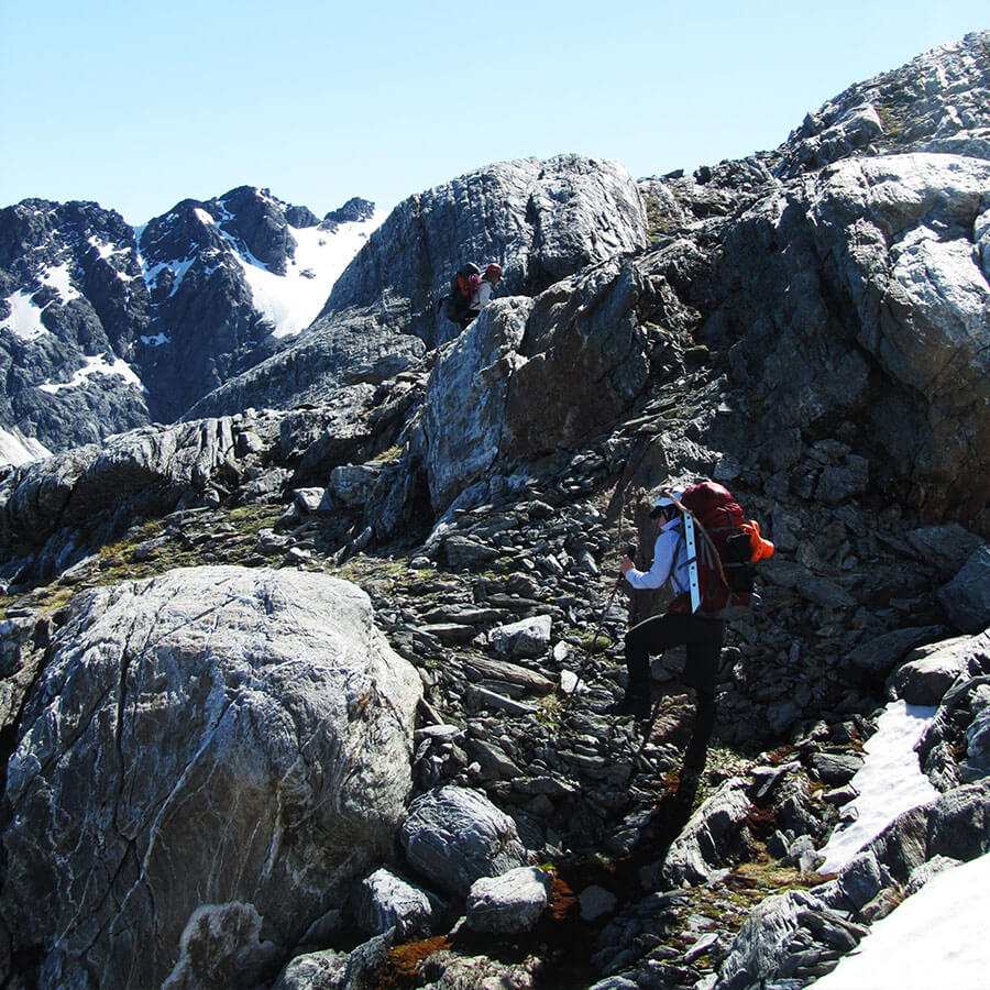
Out of the icy and snowy lands of the Gardens, the landscape changed dramatically to a rugged, rocky dusty world of boulders, scrub and dirt. We took lunch above a waterfall and then had the most horrendous traverse of the trip across thin, grassy terraces towards a huge river valley on the south side of Lambert Tops. The traverse was very tough on our nerves, still with big packs on and no traction on the scree and slippery grass beneath our feet, with sheer vertical drops into steep sided gullies below.
Thankfully, we made it across unscathed, and then quickly climbed up the river valley containing huge boulders towards the saddle. The boulders were huge and could come crashing down at any moment. At one stage, I placed my foot on a steady rock, but knocked a car sized boulder back in the direction of Dave below, only narrowly missing him! Thankfully, we were in single line and traveling far apart for that very reason. Phew!
Unfortunately, halfway up to the saddle I also managed to crush my hand under a rock whilst traversing the scree which caused blood to spurt out from under my fingernail. Not a pretty sight and one of those inexpiable types of pain with not much there to show, but a huge amount of nerve damage.
We hit the saddle and climbed up the snow bank in between points 1809m and 1936m to see the Lambert Tops beneath us and signs of West Coast bush in the distance.
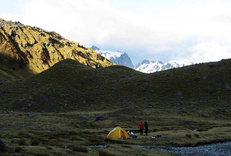
The descent to Lambert Tops was tricky too, with yet another whiteout with a maze of bluffs and steep grassy slopes to navigate through until we found the flat (and very picturesque campground) below. Fresh river water gave us energy to set up camp at 9pm in the mist and we devoured our second to last meal out in the wild. What another epic day.
Day 9 – Lambert Tops to Hunters Hut.
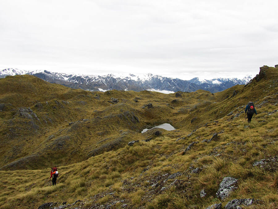
The Lambert Tops were a perfect sight after days of rock and ice. We got up at first light and headed across the limestone like rock formations towards the Lambert Tops Route hoping that we would find the path perfectly.
After an hour or so of traversing we caught a glimpse of the first signs of civilisation for days, a huge pole sticking out of the ridge. Dave ran over to the pole and gave it a little hug as we knew we were on our final descent. Unfortunately, Nikki dropped her camera in the long grass and we took a breather to look for it. After about 20 minutes of peering into never ending tussocks, I caught a glimpse of something shiny, it was a lost water bottle and Nikki’s camera.
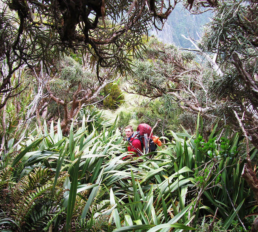
We picked up both and headed towards the trees below only to find that the ‘trail’ was pretty overgrown and very steep. Still, we had been traveling cross-country for a week now, so it was just another part of our great adventure. Tired legs, a smashed up finger and slippy mud was a shock to the system, but we persevered until we hit the lower path, 950m in elevation below where we had started for the day.
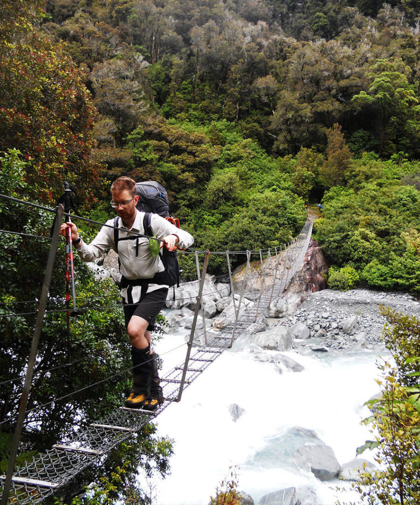
Across the swingbridge we missed the trail to the hut, but caught a glimpse of a cairn and made it into the hut for our final night’s feast, thankfully before the rain hit and the sand flies ate us all for supper! We went a little overboard on the fire after days on the ice, but it was nice to be warm and dry… and to wear some fresh clothes after 9 days of hiking.
Day 10 – Hunters Hut to Harihari.
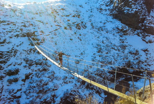
Refreshed after our warm night in a hut, we left at 6am to get make a move for the end of the road at Harihari. The overnight rain had again cleared up and we were off, although a little stiff and my feet severely pounding after the long descent yesterday. First up, the cableway across the Wanganui River; a hand driven cable car crossing for one person at a time. This was great fun and a first for me in New Zealand!!

The trail along the Wanganui was in good condition but there was a lot of boulder hopping which my feet hated, especially in boots where you lose your propreoception totally in the middle of a kilo of leather and rubber.
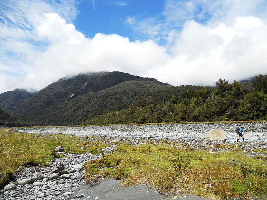
We passed through Annoyance Bluff very quickly without issues and across Mystic Flat in good time. The trail was stunning in the sunlight but the second half seemed to go on forever! Maybe it was because it was the final day of the trip or maybe it was because it was a long way, who knows. All I know is that as soon as we reached the gravel 4×4 track I immediately took off my boots and replaced them with my plastic croc styles shoes. Ahh, the bliss of relaxed feet. Wonderful!
We got to the trailhead mid-afternoon and I drew the short straw to run back into Harihari to get the car (without my now less food-laden pack!).
Apparently when you want to hitch a ride, not one single person stops. Still, I mustered a run for about 7km until I got to the outskirts of Harihari where two female French tourists kindly gave me a lift for the last km or so. I apologised to them as I must have stank after not showering for 10 days… but they were lovely and I got in the car and drove back to pick Dave and Nikki up, who were at the time being eaten by sand flies.
What an adventure! From Whataroa to Harihari across the Gardens of Eden and Allah in 10 days.