So a trip to Castle Hill Village for the weekend. The ideal break from the city life and a great time for… a spot of mountain biking along the Hogs Back and of course some 52 peaks running time (!) all next to the world famous Kura Tawhiti (Castle Hill).
Castle Hill village is a tiny settlement made of log cabin alpine-esque houses at the back of Kura Tawhiti, the conservation area of Castle Hill Station – made famous by limestone battlements which are a Mecca for climbers, scientists and outdoor lovers the world over. It’s also had some good publicity from starring in modern movies such as ‘The Chronicles of Narnia’ (which actually was filmed next door at Flock Hill another huge boulderfield).
Anyway… back to the 13th Peak! Mt Cloudsley sits at 2106m above sea level, towering above the glacial valley in which Castle Hill Village sits to the south of Craigieburn Forest Park. In Summer (which is the season at the moment) the mountain is mostly made up of scree. Not just any scree, but a fine scree which can be pretty extreme and the slopes fun for over 1000m either side dropping into the Long Creek (to the north) and Whtewater Stream (to the south).
I (with Caralyn with me) decided to take the route out of Castle Hill (700m above sea level) along the newly christened ‘Hogs Back Track‘ a purpose built bike trail that loops around the skifields and is incredibly fast and well made by hundreds of volunteers around the Canterbury region.
From the side of the Hogs Back, I took Long Spur up to the summit. It was a windy spur with pretty much no sign of tracks at the beginning, winding through scrub and bush, climbing around 100m in altitude for every 250m on the ground… lets just say it was quite steep. Then the first bluff (crag) section arrived which was tricky, but this was just the start of the scree section above.
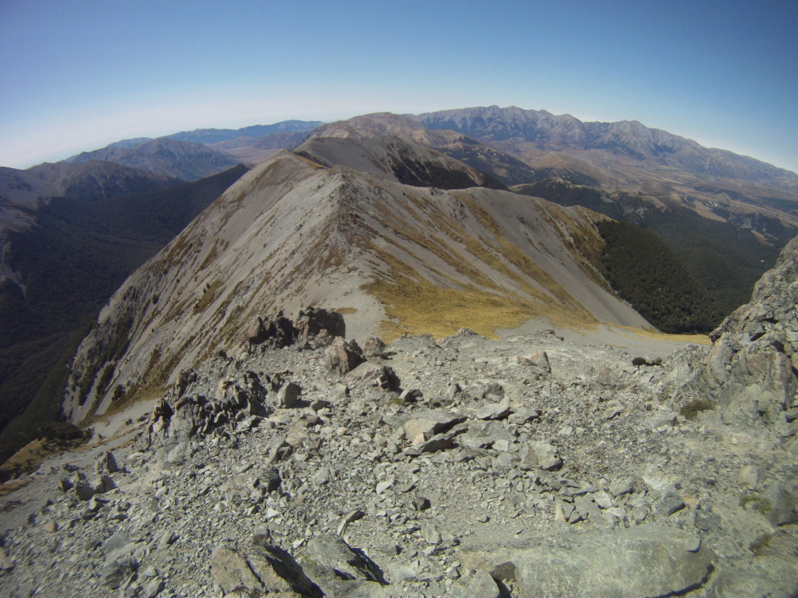
Over 1300m we were in scree territory. Steep slopes and loose rock up to the next false summit at height marker 1855m. This was the fun bit, a quite respite of downhill before the last climb through 2 bluff sections towards the 2000m mark!
A quick look at the map made me smile, I’d climbed over 1200m already in around 7km of running and the views of the Arrowsmith range were in sight. Just a little further to the 2106m mark and I was there.
What a view, blue skies, rolling cloud and only a little wind. The highest point I’ve run in the 52 Peaks challenge to date and what a day to do it.
Back down (quickly) on the scree I made it to the bottom of the river valley and attempted Leith Hill summit too (1384), but bush bashing and horrendous slippery scree meant that today we’d give that one a miss – getting to within a few hundred meters of the summit.
Never mind, the success had been complete with Mt Cloudsley for today!
Now to concentrate on map, compass and speed in the NZ National Orienteering Championships.
M
One reply on “Peak 13: Mt Cloudsley”
[…] Valley, the same area I managed to bag Peaks 8 (Hamilton Peak), 9 (Nervous Knob) and 13 (Mt Cloudsley) earlier in the […]