
So apparently it does rain in New Zealand… after months of sunshine and blue skies for the 52 Peaks, the clouds were upon me this weekend. The cloud base unfortunately was sitting at sea level and cleared at 1800m, so I was definitely in the midst of the cloud and drizzle at 1251m… my colleague Silvia was tramping above 2000m and had amazing views above the clouds, but nevermind – it’s back to normality now!
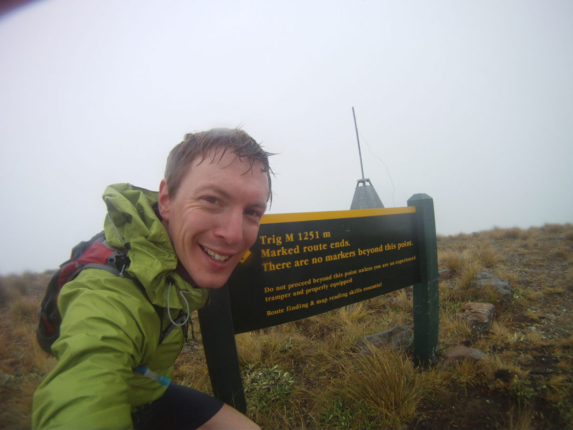
So… Rabbit Hill, a small mountain (1198m) at the west side of Porter’s Pass; part of the Korowai/Torlesse Tussockland, sitting proudly opposite the Torlesse Ranges. The route took me from the hairpin corner at Coach Stream, up to what is called ‘Trig Point M’ (1251m, which overlooks Lake Lyndon in nicer weather) and then turning to the south west to the final drop and climb up to the Rabbit Hill summit.

I made it out of the Coach Stream valley (firstly by taking the wrong path from the car park, duh!) and climbed steeply onto the Kowai Forest ridge, passing the beech trees and treeline along the way. The cloud was ok at this point, not much moisture in the air, just visibility at around 150m. After that a gentle climb to ‘Trig M’ the visibility dropped to around 40m and I literally could have been anywhere. Coasting down the scree and onto the ridgeline turning southward I tripped and fell… well that’s the short story… the long story was…. that maybe I was filming with the GoPro and ‘performing for the camera’… but enough of that (!) I managed to twist my ankle [caught red handed on camera – just…] and scratch up my knees.
Taking a few mintes to recover and going off on a 5 minute soliloquy about pain and swearing (will appear in the bloopers at some point I’m sure), I recovered and got back to running in a kind of hobble-like (not like a hobbit) fashion towards the end goal; Rabbit Hill.

From the summit, the views were rubbish to say the least. I was hoping for beautiful views of the Craigieburns and Lake Lyndon, but all I got was cloud and more cloud. Ah well – I was at last enjoying myself … the turn around!
Trying to descend off the top was then a little tricker than I imagined and even though my map skills were good, my injury and the visibility meant that I was not taking any more risks today… I decided to use a feature on my Garmin 310XT that I’ve never had to use before – “Back to Start”. A nice feature that basically drew a line on the watch and beeped at me whenever I was going off course. Perfect. I kept within around 50m of the route on the way back, passed Trig Point M and got back to the car in good time considering the ankle debacle (and even managed a spot of bouldering on the way back to the car.
After the run, how better to heal a swollen ankle than a stop at the World Famous Sheffield Pie Shop. Today’s special: Moroccan Lamb, err yes please.
Next stop – The Tararuas north of Wellington…
M.
6 replies on “Peak 10: Rabbit Hill”
[…] Anyway, happy training everyone and see you at the next peak, somewhere in the Torlesse Range/Kowai Forest… […]
Blood and gore hey … Hope the ankle is okay
Yep, not too bad now after the latest peak in the North Island… should be up to full strength this weekend!
[…] seasons for the 52 Peaks Challenge. This weekend we had the first dump of snow in the Torlesse and Craigieburn Ranges, not a lot but enough to sugar coat the peaks above 1200m, two of (Mt Lyndon […]
[…] Peak 9. Sorted. A deserved rest next, or just smash on with Peak 10? […]
[…] started from the Acheron River along Lyndon Road (passing peaks 10, 14 & 15) and followed one of it’s tributaries up to a section of forest along a farm […]